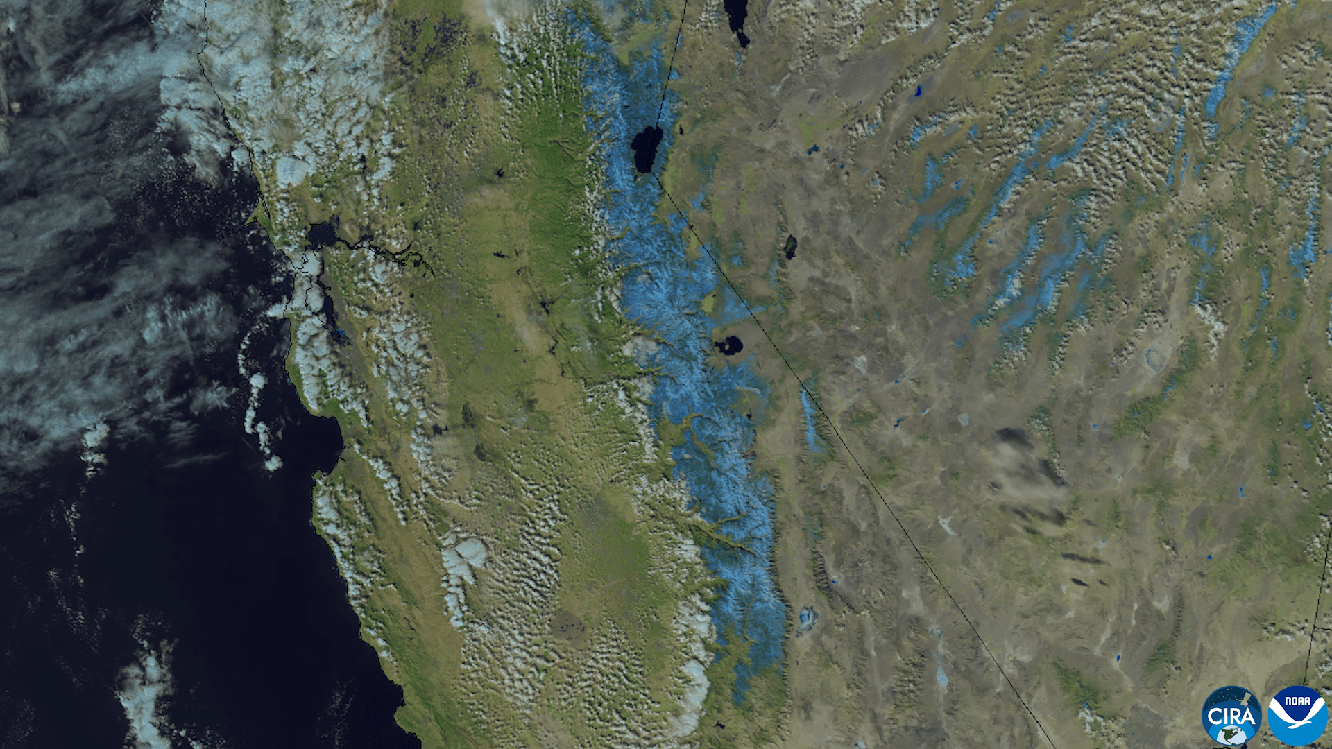
An early-season snowstorm blanketed California’s Sierra Nevada in mid-November, and more is on the way. NASA’s Earth Observatory said the Terra satellite’s MODIS instrument showed the mountains mostly bare on Nov. 12, with snow only at the highest elevations, and covered in fresh snow on the morning of Nov. 14.
The storm arrived Nov. 13 with heavy rain at lower elevations in the Sacramento area and snow accumulations of around a foot in some mountain areas, NASA said. Nearly 12 inches (30 centimeters) fell at Donner Pass, northwest of Lake Tahoe, according to the Central Sierra Snow Laboratory. The snow snarled traffic on Interstate 80, and officials closed the highway in both directions that evening.
To the south, Mammoth Mountain reported 9 to 13 inches (23 to 33 centimeters) of new snow, and Yosemite National Park officials closed several roads ahead of the storm, NASA said.
More wet weather and mountain snow are forecast. The National Weather Service issued a winter storm warning for parts of the Sierra above 5,000 feet (1,500 meters) from Nov. 18 to 20. It warned of difficult-to-impossible travel conditions, gusty winds and snow accumulations of around 4 feet (120 centimeters) possible above 8,000 feet (2,400 meters).
NASA said the storm was the first in a quick succession of Pacific storms bringing rain, snow and wind to the western U.S. in mid-November. The Earth Observatory images were made by Michala Garrison using MODIS data.
Sources & methodology
This report was written from the primary materials below. Links open at the original publisher.
NASASee something we should correct? Read our corrections policy.